Google-Backed Wildfire Satellites Reach Orbit as Smoke Blankets North America
The first three FireSat satellites launched aboard a SpaceX rocket, kicking off a system designed to spot fires as small as a backyard shed from space.
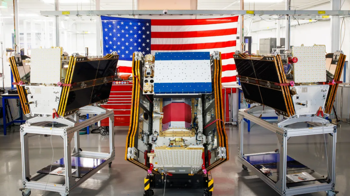
The timing was hard to miss. As smoke from hundreds of wildfires drifted across Canada and the United States, the first three operational satellites in the FireSat program lifted off from Vandenberg Space Force Base aboard a SpaceX Falcon 9 rocket on July 7, 2026. Within the year, the system is expected to start flagging small wildfires across the U.S., Australia, and Europe before they grow into the kind of blazes that choke skies for weeks.
The launch pushes FireSat into what its operators call "initial operational capability." That's a milestone, not a finish line. The three satellites now enter a three-month testing window before they begin feeding real data to fire agencies. Once that testing wraps, the constellation will be capable of scanning every fire-prone region on the planet at least twice a day.
FireSat is run by the Earth Fire Alliance, a nonprofit, and was built by Muon Space, a satellite manufacturer based in California. Google has put more than $15 million into getting the program off the ground, and the Bezos Earth Fund has kicked in $26 million on top of that. It's a notable amount of tech-money backing for a project that, at its core, is about catching fires while they're still small enough to matter.
Why smaller fires are the point
Plenty of satellites already watch for wildfires. What sets FireSat apart, according to Ars Technica's reporting, is that it's the first constellation purpose-built specifically for wildfire detection, engineered to catch fires that existing satellite systems tend to miss entirely.
Each satellite carries multispectral imaging technology, meaning it captures multiple wavelengths of light beyond what a normal camera sees, which lets it look through smoke and cloud cover. The stated goal is fires as small as five meters by five meters, roughly 16 by 16 feet. That's a backyard shed, a car, a patch of brush. It's the kind of ignition point that, caught early, might get stomped out with a shovel rather than a fleet of tanker planes.
That capability isn't theoretical. A prototype called the FireSat Protoflight satellite launched back in March 2025 and has since collected more than a million images, according to the reporting. In the process, it demonstrated it could pick out low-intensity fires that existing satellite networks simply don't see.
Who gets the data first
FireSat won't wait for the full constellation to start being useful. A group of "early adopter" agencies, including fire departments and management agencies in California, Colorado, Australia, and Portugal, will begin working with FireSat data this year as the initial three satellites come online.
The rollout timeline is aggressive. As more satellites join the constellation, FireSat aims to deliver fresh imagery from anywhere on Earth on an hourly basis by 2029. The real payoff comes later: once the full constellation of more than 50 satellites is in orbit, expected by the early 2030s, imagery refreshes would drop to every 20 minutes anywhere on the planet.
That kind of frequency is the whole point of building a dedicated wildfire constellation rather than relying on satellites designed for broader Earth-observation purposes. A fire that starts small and spreads fast can go from containable to catastrophic in the gap between satellite passes. Cutting that gap from twice-daily to every 20 minutes, at scale, changes what "early warning" actually means for the agencies on the ground trying to respond.
For now, FireSat is just three satellites and a three-month test period. But it's launching into a world where wildfire smoke has become a recurring, cross-border problem, and the agencies fighting those fires are about to get a much finer-grained picture of where the next one starts.